


应用案例
摘要
内陆河湖水环境监测对于保障生态平衡与人类健康至关重要。传统原位采样监测方法在时效性与空间覆盖度上存在显著局限。机载高光谱(Airborne Hyperspectral, HS)遥感技术以其独特的高空间分辨率、高光谱分辨率和灵活的部署能力,成为连接卫星遥感与地面原位观测的关键桥梁。本综述系统性地梳理了机载高光谱水质监测的技术工作流,从数据获取、预处理(特别强调了大气校正作为主导挑战的地位),到参数反演算法(涵盖经验、半分析及机器学习方法)的演进。本文重点评述了关键水质参数,包括叶绿素a (Chl-a)、总悬浮物 (TSS)、有色可溶性有机物 (CDOM),以及对蓝藻水华具有特异性的指示性色素——藻蓝蛋白 (PC) 的反演方法。通过在有害藻华 (HABs) 监测、污染溯源和饮用水源地保护等领域的案例分析,本综述展示了该技术的独特应用价值。同时,本文也深入剖析了当前面临的核心瓶颈,特别是二类(Case 2)水体的光学复杂性、大气校正不确定性及模型的可移植性问题。最后,本综述展望了未来的发展趋势,强调了多平台(天-空-地)协同观测、人工智能与深度学习的变革性潜力,以及以超表面为代表的新型低成本传感器技术,将共同推动该领域从科学研究向标准化、业务化监测的根本性转变。
河湖等内陆水体是地球表层系统中最活跃的组成部分之一,它们不仅是维系生态平衡的关键节点,也是人类社会赖以生存和发展的重要水资源来源 1。然而,随着全球城市化、工业活动和农业实践的加剧,过量的营养盐、污染物和悬浮泥沙进入水体,导致水质恶化、富营养化、有害藻华(HABs)频发等一系列严峻的环境问题 2。因此,对河湖水质进行及时、准确、全面的监测,是实现水资源可持续管理和保护公众健康的前提。
目前,水质监测的“金标准”仍然是基于实地采样点的原位测量和随后的实验室化学分析 4。这种方法在单点上具有高精度,但其固有的局限性也日益凸显。首先,传统方法是劳动密集型和资本密集型的,涉及昂贵的采样设备、运输和高昂的化验成本 2。其次,其时空代表性严重不足。采样点在空间上是稀疏的,采样周期(通常为每周或每月)在时间上是低频的 4。这种“以点代面”的稀疏数据,无法捕捉到水环境参数(如藻华暴发、污染团扩散)的快速、动态和高度异质性的时空变化过程。这种“数据鸿沟”不仅是一个后勤问题,它从根本上阻碍了我们对水生生态系统动态的全面理解和预警管理能力的提升。
图1 传统水质监测的局限性
为了克服传统方法的局限,遥感技术(Remote Sensing, RS)作为一种非接触、大范围、近实时的监测手段,已成为水环境监测领域不可或缺的工具 2。在过去的几十年中,以MODIS、Landsat系列和Sentinel系列为代表的卫星遥感平台,为我们提供了全球尺度、长时序的水质变化图景 2。然而,卫星遥感在应用于复杂的内陆水体(尤其是中小型河湖)时,仍面临三大瓶颈:(1) 空间分辨率相对较低(例如Landsat为30m,Sentinel-2为10-60m),难以精细刻画河道、岸线、排污口等小尺度特征 8;(2) 时间分辨率固定(数天至十数天),难以捕捉突发性污染或藻华的快速生消过程 9;(3) 云层遮挡,尤其在多云雨的季节,卫星数据获取严重受限,导致关键监测窗口期的信息丢失 10。
为了填补这一关键的数据空白,机载高光谱遥感技术应运而生 4。机载高光谱(如AVIRIS, CASI, Resonon Pika等)系统 10 提供了一种独特的价值主张,其核心优势体现在三个方面:
1. 极高的空间分辨率:机载平台通常可以获取亚米级到米级的空间分辨率 10,能够清晰识别卫星像元无法分辨的精细结构,如小型支流、排污口羽流、城市黑臭水体等。
2. 极高的光谱分辨率:这是高光谱技术最核心的优势。传感器在可见光至近红外(VIS-NIR)波段内,以纳米级的间隔连续采集数百个(200+)光谱通道 10。这种“光谱指纹”级别的精细信息,使得区分具有相似光学特性、但在特定窄波段存在细微差异的水体组分(例如,区分叶绿素a和藻蓝蛋白)成为可能 12。
3. 极高的部署灵活性:机载平台可以根据监测需求(如突发污染、藻华暴发)“按需”部署,并能够选择在云层以下飞行 10。这种灵活性使其成为一种强大的应急响应和高精度数据采集工具,完美补充了卫星受制于轨道和天气的不足。
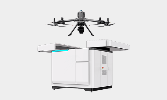
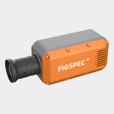
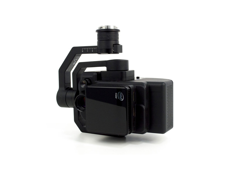
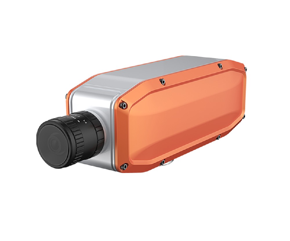
机载高光谱(见图2)并非卫星遥感的竞争者,而是其不可或缺的“赋能者”。它构成了连接稀疏但高精度的“地面点”(原位采样)与全面但相对粗糙的“卫星面”(卫星影像)之间的关键“校准/验证桥梁”。许多先进的卫星水色算法(例如用于PACE卫星任务的算法)正是依赖于机载高光谱数据进行开发和验证的,这是其对水环境科学最重要的贡献之一。

图2机载高光谱相机
尽管卫星遥感 7 和无人机(UAV)遥感 1 在水质监测中的应用已有大量综述,但针对机载高光谱这一兼具高保真度和较大覆盖范围的特定技术平台的系统性总结仍显不足。本文旨在全面、深入地梳理机载高光谱遥感在河湖水质监测中的应用现状。本文将从技术原理与工作流出发(第2节),系统评述主要水质参数的反演算法(第3节),并结合典型案例展示其在关键领域的应用(第4节)。随后,本文将批判性地分析当前该技术面临的核心挑战(第5节),并展望未来在多平台融合、人工智能和新一代传感器驱动下的发展趋势(第6节)。
表1:不同水质监测平台的关键特性对比
平台 | 空间分辨率 | 光谱分辨率 | 时间分辨率/灵活性 | 成本 | 核心优势 | 核心局限 |
实地采样 | 点(厘米级) | N/A (化学) | 低频(周/月) | 高 | 最高精度(金标准) | 时空代表性极差 [2, 4] |
地面光谱站 | 点(米级) | 高光谱 | 极高(分钟级) | 中 | 连续时间序列监测 13 | 空间代表性差(单点) |
极高(厘米级) | 高光谱 | 极高(按需) | 低-中 | 极高分辨率;按需响应 14 | 空间覆盖范围小(局部) | |
机载高光谱 | 高(亚米-米级) | 高光谱 | 高(按需;可飞云下) | 高 | 高时空保真度;灵活性 10 | 飞行成本高;非连续 8 |
卫星遥感 | 中-低(10m-1km) | 多光谱/高光谱 | 中-高频(天/周) | 低(数据) | 全球覆盖;长时序 2 | 空间分辨率低;受云层限制 9 |
水体的“颜色”,即水色,是由水体本身以及水中的各悬浮和溶解组分对太阳光(电磁辐射)的吸收和散射共同作用决定的 15。这些光学过程由水体的固有光学特性(Inherent Optical Properties, IOPs)——即吸收系数(a)和散射系数(b)——所控制。遥感监测水质的基本原理,就是通过传感器测量水体表层离开水面的光谱辐射特征(即遥感反射率, Rrs),并反向推演(Invert)出IOPs,进而建立IOPs与水质参数浓度之间的物理或统计关系 6。
在内陆河湖(即“二类水体”,Case 2 Waters)中,决定水体光学特性的主要有三大类物质 6:
1. 浮游植物(叶绿素a, Chl-a):作为光合作用的主要色素,浮游植物在蓝光波段(约440nm)和红光波段(约670nm)有强烈的吸收峰。此外,它们在红光波段被激发后,会在近红外波段(约685nm)产生一个特征“荧光峰”(见图3) 18。

图3 叶绿素-a荧光峰在两侧连接线上方的高度
1. 总悬浮物 (TSS):主要由无机矿物颗粒和有机碎屑组成。TSS的主导光学特性是强烈的后向散射 19。其散射能力随波长增加而缓慢降低,导致水体在红光和近红外(NIR)波段的反射率显著提高,这是浑浊水体呈现“黄褐色”的直接原因。
2. 有色可溶性有机物 (CDOM):也称“黄腐物质”,是来自陆源或水体内部有机物降解的溶解性物质。CDOM在蓝光和紫外(UV)波段具有极强的吸收能力,且其吸收能力随波长增加呈指数型衰减 21。高浓度的CDOM使水体呈现“茶色”或“黑色”。
二类水体的核心挑战在于,上述三种组分的光学信号是高度混合且相互重叠的(见图4) 17。例如,在蓝光波段,Chl-a和CDOM都在强烈吸收。高光谱遥感的价值正在于它提供了足够的光谱细节,使得利用先进算法“解耦”(Deconvolve)这些复杂的、重叠的光谱特征成为可能。

图4内陆水域非吸水特性(a-d)和边际密度曲线(e)三元图
机载高光谱水质监测是一个复杂的多步骤流程,可概括为:(1) 飞行规划与数据获取;(2) 数据预处理;(3) 水质参数反演;(4) 产品生成与验证。其中,预处理(尤其是大气校正)和反演算法是整个流程的核心与难点。
数据获取涉及详细的飞行规划,必须综合考虑太阳高度角(避免水面镜面反射)、天气条件(避免云影)、飞行高度(决定空间分辨率)和航带重叠度等因素。
原始数据(“L0”级)是传感器记录的原始数字信号(DN值)。预处理首先要进行辐射定标,将DN值转换为具有物理意义的、传感器入瞳处的“表观辐射亮度”(Ls)。随后进行几何校正,利用机载GPS/IMU(惯性测量单元)数据和地面控制点,对图像进行正射校正和地理配准,消除由飞机姿态变化引起的几何畸变。
大气校正是水色遥感中技术难度最高、也是不确定性最大的一个环节 (见图5)22。传感器在空中接收到的总信号(Ls)中,真正来自水体的“离水辐射亮度”(Lw)通常只占极小的一部分(在蓝光波段可能低于10%)。绝大部分信号来自于大气分子的瑞利散射、气溶胶(雾霾)的米氏散射以及太阳辐射在大气中的吸收 22。

图5 基于 CASI-1500 机载高光谱数据的大气校正与水离辐射率(Ln)反演方法研究
大气校正的目的,就是从Ls中精确地剥离所有大气和水面(如太阳耀光)的影响,从而得到归一化的“遥感反射率”(Rrs)。这一过程通常依赖于复杂的、基于物理的辐射传输模型(RTM),如FLAASH (Fast Line-of-sight Atmospheric Analysis of Spectral Hypercubes) 24 或 6S (Second Simulation of the Satellite Signal in the Solar Spectrum) 模型。FLAASH通过调用嵌入的MODTRAN辐射传输模型 24,结合用户输入的传感器参数和大气参数(如气溶胶模型、能见度),逐像元地求解辐射传输方程,反演出地表(水面)反射率 27。然而,在内陆水体应用中,标准的大气校正算法面临着一系列严峻的挑战,使其成为整个流程的“阿喀琉斯之踵” 23:
● 邻近效应 (Adjacency Effect):机载高光谱具有高空间分辨率,但也使其对“邻近效应”极为敏感。水体(暗目标)周围的明亮地表(如植被、建筑物)反射的强光,会通过大气散射“溢出”并污染到邻近的水体像元上,导致水体(尤其是近岸和狭窄河道)的反射率被严重高估 28。
● 气溶胶模型不确定性:内陆(尤其是城市和工业区)的气溶胶类型复杂多变,而RTM模型中的标准气溶胶类型(如“乡村型”、“海洋型”)往往无法准确描述真实的大气状况。
● 近红外(NIR)假设失效:传统海洋水色的大气校正算法(如SeaWiFS的“黑像元”法)假设水体在NIR波段的反射率为零(Rrs(NIR)≈0),从而利用NIR波段的信号来反演气溶胶参数。然而,在TSS浓度高的内陆浑浊水体中,水体在NIR波段具有强烈的散射信号,导致这一假设完全失效 28。
在获取了(假设是准确的)Rrs光谱后,下一步是利用反演算法(Retrieval Algorithm)来估算水质参数浓度。这些算法主要分为三大类(见表2)。
该类方法不(或很少)涉及水体光学机理,而是通过数理统计方法,直接建立Rrs(或其组合)与现场实测的水质参数浓度之间的回归关系 6。最常见的形式是波段比值、波段组合或光谱指数。
例如,归一化差异叶绿素指数(NDCI) 就是一种广泛应用的半经验模型,它利用了叶绿素的红光吸收和近红外反射特性 29。这类模型具有简单、计算速度快的优点。然而,其致命弱点在于缺乏普适性。一个在A湖区通过实测数据回归建立的模型,当应用到光学特性截然不同的B湖区时,其精度往往会急剧下降 30。它们是高度“地点特异性”和“时间特异性”的。
该类方法基于辐射传输理论和水体生物光学模型,是目前水色遥感领域的主流和研究前沿 6。其思路不是直接从Rrs反演到浓度,而是分两步走:
1. IOPs反演:利用半分析模型,将Rrs光谱分解(Decompose)为其背后的物理量——总吸收系数(a(λ))和总后向散射系数(bb(λ)) 15。
2. 浓度估算:将a(λ)和bb(λ)进一步分解为各组分(浮游植物、CDOM、TSS)的贡献,再通过各自的“比吸收/比散射系数”(生物光学量)换算为浓度。
准分析算法(Quasi-Analytical Algorithm, QAA) 是该领域最著名和应用最广的半分析模型之一 17。QAA由Lee等人(2002)开创 32,它通过一系列解析步骤,首先估算一个参考波长(如555nm)的总吸收系数,然后利用已知的纯水吸收光谱和预设的生物光学模型(如CDOM和颗粒物的吸收光谱形态),逐步迭代求解出所有波段的a(λ)和bb(λ)。
分析方法的优势在于其物理基础,IOPs是水体的固有物理属性,因此基于IOPs建立的模型具有更强的可移植性和鲁棒性。但QAA最初是为开阔大洋(一类水体)设计的 17,在应用于光学特性极其复杂的内陆浑浊水体时,其内部假设(如光谱斜率、参考波长选择)往往不再适用,必须进行针对性的(Re-parameterization) 或模型结构优化,才能获得可靠的结果 16。
表2:三类主流水质参数反演算法对比
算法类别 | 原理 | 典型示例 | 优势 | 劣势 |
经验/半经验 | 基于统计回归; | NDCI (叶绿素) 29
红/近红外波段比值 (TSS) | 简单、快速、易于实现 | 物理意义不明确;
普适性差,高度依赖现场数据 30 |
分析/半分析 | 基于物理模型; | QAA [17, 32] SOLID (TSS) 20 | 物理基础明确; 模型鲁棒性、可移植性强 | 算法复杂; 对大气校正精度极度敏感 17 |
机器学习 | 基于数据驱动; | 随机森林(RF) 7 深度学习(CNN, RNN) 37 | 能处理高维非线性关系 6; 可反演非光学活性参数 | 依赖海量训练数据; 物理可解释性较弱(传统ML) |
机载高光谱的精细光谱分辨率使其在反演特定水质参数时具有多光谱传感器无法比拟的优势。
Chl-a是表征浮游植物生物量和水体富营养化程度的核心指标 29。除了使用NDCI等宽波段指数外 29,高光谱遥感可以利用Chl-a在685nm附近的光合作用荧光峰。
荧光线高度(FLH) 模型是专为高光谱数据设计的经典算法 18。其原理是,在荧光峰(约705nm,λmax)两侧选择两个“肩部”波段(如λ1=679nm,λ2=748nm)建立一个线性基线(Baseline),然后计算λmax处的反射率高出该基线的“高度”(Line Height)(见图6) 18。如公式(1)所示:FLH = R_{rs}(lambda_{max}) − left
FLH模型在浑浊的二类水体中表现优异 18,因为它通过基线相减,在很大程度上扣除了来自TSS和CDOM的背景信号干扰,从而更特异性地隔离出了来自浮游植物的荧光信号 18。

图6叶绿素-a荧光峰在两侧连接线上方的高度
TSS是控制水体透明度和光场的核心因素 19。由于TSS在红光和近红外波段(600-900nm)的强散射特性,该波段范围内的单波段或波段比值(如Rrs(700)/Rrs(550))是反演TSS浓度的最常用经验方法 19。
然而,在光学特性动态范围极大的内陆水域(TSS浓度可跨越几个数量级),单一的经验模型难以适用。为此,研究者开发了更先进的算法,例如SOLID (Statistical, IOP-based, and muLti-conditional Inversion proceDure) 算法 20。SOLID算法的核心思想是一种“分类-反演”的条件逻辑 20:
1. 水体分类:首先根据输入的Rrs光谱形态,将水体自动划分为不同的光学类型(如“高TSS低Chl-a”、“高Chl-a高TSS”等)。
2. 条件反演:根据该像元所属的水体类型,调用一个为此类型专门优化的反演模型(可以是半分析、机器学习或经验模型)来估算后向散射系数bbp。
3. TSS估算:最后,利用特定水体类型的bbp与TSS之间的经验关系,计算TSS浓度。
SOLID模型的设计理念,是对“一刀切”反演算法的重大突破,它承认并适应了内陆水体光学特性的高度复杂性和区域性差异20。
CDOM是重要的碳循环示踪物和水体光学特性的调节者 41。其光谱特征是在蓝光波段(如412nm, 440nm)的强吸收 21。反演CDOM的难点在于如何将其吸收信号从同样在蓝光波段吸收的浮游植物色素中分离出来。这通常需要依赖于QAA等半分析模型 17,通过模型假设(如CDOM的光谱吸收斜率)来解析总吸收中CDOM的贡献。
SDD(塞克盘深度)是一个综合性的光学指标,直观反映了水体的清澈程度 21。它不是某一种特定物质的浓度,而是受TSS、Chl-a和CDOM共同衰减作用的综合体现。因此,SDD的反演几乎完全依赖于经验或半经验模型,例如,通过建立Rrs(通常在绿光或红光波段)与实测SDD值之间的直接回归关系来实现 44。
在水质监测领域,特别是公共卫生预警方面,藻蓝蛋白(PC)是一个具有革命性意义的新兴参数。其重要性在于:Chl-a存在于所有藻类中(包括有益的硅藻、绿藻),而PC是蓝藻(Cyanobacteria,即“蓝绿藻”)几乎独有的一种特征性辅助色素 12。蓝藻是全球淡水水体中有害藻华(HABs)的主要肇事者,其中许多物种能产生强烈的神经毒素和肝毒素(如微囊藻毒素, MCs)。
因此,监测PC浓度,使得管理者能够从“监测水华”转向“监测有毒水华” 12。研究发现,PC浓度与蓝藻细胞密度及微囊藻毒素含量具有很强的相关性 (见图7)12。
PC的光谱特征是在约620nm处有一个明显的吸收谷 12。这一特征非常窄,在Sentinel-2或Landsat等传统多光谱传感器的宽波段中会被“平均掉”而无法识别。只有机载或无人机的高光谱传感器,凭借其纳米级的光谱分辨率,才能准确捕捉到620nm处的吸收特征。目前,针对性的半分析嵌套波段比值算法已被证明可以高精度地反演PC浓度 12,这为HABs的早期、特异性预警提供了有力的技术武器。

图7藻蓝蛋白(PC)—— 有毒水华早期预警特异性指标的光谱特征对比(传统多光谱与高光谱传感器及 620nm 吸收谷分析
机载高光谱的独特优势使其在传统遥感手段难以胜任的精细化监测场景中发挥着关键作用。
北美五大湖之一的伊利湖(Lake Erie)长期受到严重富营养化和有害蓝藻水华(HABs)的威胁,严重威胁了沿湖数百万居民的饮水安全 50。
案例分析:NOAA与NASA的伊利湖联合监测行动
美国国家海洋和大气管理局(NOAA)大湖环境研究实验室(GLERL)和美国国家航空航天局(NASA)格伦研究中心(Glenn)自2014年以来,在藻华季(夏秋季)持续开展业务化的机载高光谱监测 10。
该行动的核心价值在于其灵活性和高保真度。他们使用搭载在轻型飞机上的Resonon Pika等高光谱成像仪 10,以每周的频率,在卫星无法穿透的云层之下飞行 10。获取的1米空间分辨率、240+波段的高光谱数据 10,不仅能精细刻画藻华在湖湾(如Maumee Bay)中的涡旋和条带状分布(见图8),更重要的是,能够反演藻蓝蛋白(PC)浓度,从而区分有毒蓝藻和无害藻类 10。这些近乎实时的藻华类型和空间分布图,会迅速分发给沿岸的自来水厂和水务管理者,帮助他们决策(如调整取水口位置、增加活性炭处理量),以避免毒素进入供水系统 10。

图8藻华在湖湾(如Maumee Bay)中的涡旋和条带状分布
城市水体(如内河、排污渠)受到来自工业点源和城市面源的复杂污染 14。高分辨率遥感是识别污染“热点”和追踪污染源的有力工具 14。
案例分析:从卫星到无人机的污染羽流追踪
在污染溯源方面,不同分辨率的传感器扮演着不同角色。
● 卫星尺度(概念验证):对葡萄牙São Jacinto排污口的研究显示,Sentinel-2卫星的10米分辨率数据足以识别出排海口释放的、绵延数公里的持久性污染羽流。通过光谱分析发现,该羽流具有与周围海水(TSS主导)截然不同的高CDOM(暗色)光谱特征,证明了其来自城市和工业污水(见图9) 53。

图9无云日海水 (蓝色图钉)、阿威罗泻湖径流 (红色图钉)和圣哈辛托海排放口羽流(黑色图钉)的真彩色图像和光谱特征示例(2019年3月21日)
● 无人机尺度(精细识别):一项在中国广州城市河道的研究 51,利用了无人机高光谱(UAV-HS)和深度学习(CNN-Attention)模型。其亚米级分辨率的成果图(在图8中有展示)揭示了传统监测完全无法发现的细节:在人口密集区和特定排口附近,总氮(TN)、总磷(TP)等污染物呈现出清晰的、小尺度的“热点”分布 51。
机载平台的“桥梁”角色:上述案例凸显了机载平台的中间定位。对于一个完整的城市河网或大型港口(如São Jacinto) 53,无人机的航程(UAV-HS)过短 14;而卫星(Sentinel-2)的分辨率又不足以定位到广州案例中的小型排污口 9。机载高光谱平台 14 能够在一次飞行中覆盖整个城市河网,同时保持米级分辨率,使其成为在“流域”尺度上定位“污染热点区域”的理想工具。
保护饮用水水库免受藻华、污染物侵袭,是水安全保障的重中之重 1。
案例分析:比利时Blankaart水库的HYPSTAR监测系统
在比利时的Blankaart水处理中心,研究人员部署了一套固定式、地基高光谱监测系统(HYPSTAR),该系统持续(高时间分辨率)对水库水面进行观测(见图10)13。
虽然此案例并非“机载”,但其在业务化应用上的理念极具参考价值。该系统通过连续的光谱测量,实现了对Chl-a、SPM(悬浮颗粒物)浓度的近实时反演,并初步验证了对PC浓度的监测能力 13。研究证实,该系统可作为一种“快速、低成本的方法来探测和监测浮游植物水华”,为水厂的运行管理提供了关键的预警信息 13。
这一案例启发我们,机载高光谱监测提供了该固定点监测的空间维度。当HYPSTAR在A点发出预警时,机载平台可以立即起飞,在数小时内绘制出整个水库的污染或藻华空间分布图,评估其规模、来源和移动方向,从而实现从“点”预警到“面”管理的跨越。

图10每天采集的有效序列数(“所有序列”),以及去除不满足以下滤波器的光谱后剩余的序列:(1)滤波器1:Lu(λ)/Ed(λ)800 至 950 nm 之间 > 0.025 SR−1;(2)过滤器2:ε(720,780)> 0.005;(3)滤光片3:去除400–900 nm范围内的负反射率数据。请注意,仪器在 2022 年 2 月至 4 月期间进行了维护和重新校准
尽管机载高光谱技术取得了显著进展,但在其走向大规模业务化应用的道路上,仍有几个关键的技术瓶颈亟待突破。
如2.2.2节所述,大气校正的精度是水色遥感的最大不确定性来源 23。在内陆水体这一特定场景下,问题被进一步放大 28。
● 暗目标-亮背景:中小型湖泊和河流通常被明亮的陆地(植被、城市)包围。强烈的“邻近效应”会污染水体光谱 28,而现有的校正模型(如FLAASH)对此的处理能力仍显不足。
● 气溶胶复杂性:内陆(尤其是人类活动强烈的区域)气溶胶类型多变且难以准确估算 28。
● 算法失效:在浑浊水体中,NIR波段信号不为零,导致基于NIR假设的标准大气校正算法彻底失效 28。
目前,没有一种单一的大气校正算法能够在所有水体类型和大气条件下都表现(21)。这种不确定性会非线性地传递到下游的反演算法中,导致最终的水质产品出现巨大偏差。
内陆二类水体是一个光学“熔炉” 17。Chl-a, TSS, CDOM三种组分各自的浓度都可能很高,且变化范围极大(例如,研究显示Chl-a浓度可高达700 mg/m³ 16)。它们的光谱信号强烈重叠(例如,Chl-a和CDOM都在蓝光波段强吸收)。即使拥有数百个波段,如何从这种复杂的“混合光谱”中稳健地解耦出单一组分的贡献,仍然是生物光学建模的核心难题。
水质反演模型,无论是经验模型还是半分析模型,都存在严重的“可移植性”或“普适性”问题 30。为一个湖泊(如太湖 35)的实测数据集标定和优化的模型,几乎不可能被直接应用于另一个具有不同生物光学特性的湖泊(如伊利湖)。这意味着,每一次新的监测任务都可能需要重新开展一次昂贵、耗时的地面同步实测采样,以对模型进行本地化的校准和验证。这一瓶颈极大地阻碍了机载高光谱技术向标准化、可复制的业务化监测服务转化。
机载高光谱监测的成本高昂 8。这不仅包括传感器的购置成本,还包括每次飞行的飞机租赁、飞行员、地面保障和数据处理的费用。高昂的成本使其难以实现像卫星那样的持续、高频(如每日)观测 2。因此,机载高光谱目前更多地被用作一种“快照”式的、服务于特定科研活动或应急响应的工具,而非常态化的监测手段。这也是近年来,成本更低、部署更灵活的无人机高光谱平台(UAV-HS)备受关注的原因 1。
高光谱数据处理链(见2.2节)是一个极其复杂且专业的流程。一个高光谱数据立方体(Data Cube)的数据量动辄数十GB。操作人员不仅需要昂贵的专业软件(如ENVI + FLAASH模块 24),还必须具备深厚的遥感物理、光学和计算机科学背景。这种高企的“专业壁垒”,使得绝大多数地方环保部门或水务管理者无法自行处理和分析数据,严重限制了该技术的普及和应用。
面对上述挑战,机载高光谱领域正在经历一场深刻的技术变革,其未来发展将主要由数据融合、人工智能和传感器革新共同驱动。
未来水质监测的图景,不是由某一种“平台”主导,而是由一个多平台、多尺度、协同观测的“系统之系统”构成 56。在这个金字塔形的观测体系中:
● 天基(卫星) 2:提供全球覆盖、高频重访的“宏观背景”和“长时序基线”。
● 空基(机载):提供区域尺度、高保真度的“校准快照”,用于验证卫星算法和精细过程研究。
● 低空(无人机) 59:提供局部尺度、超高分辨率、按需响应的“热点详查”。
● 地基(固定站) 13:提供关键节点(如取水口、排污口)的“连续时间序列”锚点。
在这种融合范式下,一个极具潜力的前沿方向是利用高精度平台(空-地)数据来主动校正低精度平台(天基)数据。例如,“地-空-天”大气校正(GASAC) 方法 60。该方法利用无人机或地面测量的、已知的“真实”Rrs光谱作为训练数据,去训练一个机器学习模型(如Transformer 60),使其学习到从卫星“表观辐射亮度(TOA)”到“真实Rrs”的映射关系。这种方法本质上是为该颗卫星、在该区域、在该时间,定制了一个完美的大气校正模型,从而将无人机的灵活性与卫星的广域覆盖能力结合起来 (见图11)60。

图11最佳Chl-a浓度反演模型产生的结果的散点图
人工智能(AI),特别是机器学习(ML)和深度学习(DL),正在为解决水色遥感的非线性、高维度难题提供强大的新工具 6。
1. 更优的反演模型:与传统回归或半分析模型相比,深度学习模型(如卷积神经网络CNNs、循环神经网络RNNs)能够从高光谱数据中自动学习和提取复杂的、非线性的光谱-空间联合特征 62。这使得它们在反演常规参数时精度更高,并且在反演传统光学模型难以处理的“非光学活性参数”(如总氮TN、总磷TP、重金属)方面显示出巨大潜力 14。
2. 可解释AI (Explainable AI):新兴的DL模型正试图摆脱“黑箱”的诟病。例如,一项研究中使用的CNN-注意力-残差(CAR) 模型 51,其“注意力机制”可以反向输出模型在进行反演时,“最关注”哪些光谱波段。这不仅提高了模型的可信度,甚至有助于我们发现新的、未知的参数敏感波段,反哺物理模型的改进 51。
3. “端到端”反演:一个更具革命性的方向是,训练一个深度神经网络,其输入为原始的、未经大气校正的传感器表观辐射亮度(TOA)数据,其输出则直接是最终的水质参数图。该网络被期望能够在其隐藏层中,同时学习并模拟复杂的大气辐射传输过程和水体生物光学过程。这种“端到端”的思路一旦成熟,将彻底绕过整个流程中最脆弱、最不确定的大气校正环节。
长期以来,高光谱传感器高昂的成本和巨大的体积、重量、功耗(Size, Weight, and Power, SWaP)是阻碍其普及(特别是上UAV和机载)的核心物理限制。
这一障碍正在被传感器技术的革新迅速瓦解。我们正处在一个高光谱成像“民主化”的时代 1。一方面,以Resonon Pika为代表的轻量化、低成本商用传感器已日趋成熟 10。另一方面,更具颠覆性的是新型计算光学的兴起。
以超材料(Metamaterials)和超表面(Metasurfaces)为代表的新型微纳光学技术,允许研究人员在亚波长尺度上任意调控光场。这使得使用单一的、平面化的、通过微影光刻制造的“超透镜”或“超滤光片”,来替代传统成像光谱仪中那些笨重、复杂、需要精密校准的透镜组、光栅或滤光片轮成为可能。这一技术趋势预示着,未来高光谱传感器的SWaP和制造成本将出现数量级的下降。高光谱成像技术将从一种“阳春白雪”式的、昂贵的科研工具,转变为一种“商品化”的、可被广泛部署的传感器。它将被集成到每一架行业UAV上,或以“阵列”形式部署在河湖岸基,实现对水环境的泛在、高密度感知 13。
技术发展的最终目标,是将其从科学论文转化为水务管理者手中稳定可靠的业务化工具 13。这需要解决“最后一公里”问题。未来的趋势是建立标准化的、自动化的“分析就绪数据”(Analysis-Ready Data, ARD)产品体系。水务管理者需要的不是一个100GB的高光谱数据立方体,而是在飞行结束后24小时内,推送到其网页浏览器上的一张经过验证的、易于理解的“藻蓝蛋白浓度分布图”或“污染风险等级图” 10。这要求整个行业建立标准化的数据处理链、质量控制(QC)流程和产品分发规范。
机载高光谱遥感技术,凭借其在高空间分辨率、高光谱保真度和高部署灵活性上的独特组合,填补了卫星遥感与地面监测之间的关键空白。它在精细监测与预警方面(如识别有毒蓝藻水华 10、追踪城市污染“热点” 51)所展现出的不可替代的价值,已在众多研究和业务化案例中得到充分证明。
然而,该技术目前仍面临严峻的挑战。大气校正在光学复杂的二类水体中的不确定性 23,以及反演模型的区域局限性与可移植性差 30,是阻碍其广泛应用和标准化的两大核心技术瓶颈。
展望未来,水环境管理正迈向“数字孪生”的新时代。这一时代的基石,将不再是单一的传感器,而是由卫星、机载、无人机和地面站构成的多平台协同观测网络。在这个新的范式中,人工智能将成为融合多源异构数据、深度挖掘信息的“智慧大脑”,而以超表面光学为代表的新一代低成本、轻量化高光谱传感器,将成为无处不在的“敏锐眼睛”。二者的结合,将最终推动水环境监测从昂贵的科学研究走向普惠的、精准的、智能化的业务管理,为保护我们日益承压的水资源提供决定性的技术支持。
2 Frontiers Media S.A. (2025). Annual trends in research. The Sentinel-2 MSI... (Accessed from https://www.frontiersin.org/journals/environmental-science/articles/10.3389/fenvs.2025.1549301/full)
7 MDPI. (2024). Review of Recent Advances in Remote Sensing and Machine Learning Methods for Lake Water Quality Management. (Accessed from https://www.mdpi.com/2072-4292/16/22/4196)
4 MDPI. (2024). Airborne Sensors... (Accessed from https://www.mdpi.com/1424-8220/24/24/8041)
8 ResearchGate. (n.d.). Airborne sensors promise greater accuracy... (Accessed from(https://www.researchgate.net/publication/274027087_Airborne_Hyperspectral_Remote_Sensing_to_Assess_Spatial_Distribution_of_Water_Quality_Characteristics_in_Large_Rivers_The_Mississippi_River_and_Its_Tributaries_in_Minnesota))
11 University of North Dakota. (n.d.). Use of Hyperspectral Remote Sensing to Estimate Water Quality. (Accessed from https://commons.und.edu/cgi/viewcontent.cgi?article=1012&context=geo-fac)
4 MDPI. (2024). constraints, conventional on-site monitoring methods fall short... (Accessed from https://www.mdpi.com/1424-8220/24/24/8041)
5 MDPI. (2024). traditional monitoring technology is associated with risks... (Accessed from https://www.mdpi.com/2073-4441/17/20/3000)
2 Frontiers Media S.A. (2025). Traditional water quality monitoring methods (laboratory and in situ measurements) are limited spatially... (Accessed from https://www.frontiersin.org/journals/environmental-science/articles/10.3389/fenvs.2025.1549301/full)
3 AGU. (2025). Traditionally, water quality has been assessed using manual sampling... (Accessed from https://agu.confex.com/agu/agu25/meetingapp.cgi/Paper/1881487)
6 PubMed. (2024). Remote sensing technology has increasingly demonstrated its potential... (Accessed from https://pubmed.ncbi.nlm.nih.gov/39369506/)
24 Spectral Sciences, Inc. (n.d.). Software: Spectral Image Exploitation – FLAASH®. (Accessed from https://www.spectral.com/our-software/flaash/)
22 MDPI. (2021). Atmospheric correction removes or reduces the effects caused by... (Accessed from https://www.mdpi.com/2072-4292/13/24/5062)
25 MDPI. (2018). A comparison with the results of atmospheric correction in module FLAASH... (Accessed from https://www.mdpi.com/2072-4292/10/11/1698)
27 NV5 Geospatial Software. (n.d.). FLAASH® is a first-principles atmospheric correction tool... (Accessed from(https://www.nv5geospatialsoftware.com/docs/FLAASH.html))
26 DTIC. (2004). FLAASH (Fast Line-of-sight Atmospheric Analysis of Spectral Hypercubes)... (Accessed from(https://apps.dtic.mil/sti/tr/pdf/ADA423120.pdf))
29 U.S. National Institutes of Health (NIH). (2024). Normalized Difference Chlorophyll Index (NDCI)... (Accessed from https://pmc.ncbi.nlm.nih.gov/articles/PMC11235139/)
38 MDPI. (2024). Chlorophyll-a (Chl-a) is commonly used as a biological indicator... (Accessed from https://www.mdpi.com/2072-4292/16/22/4323)
9 ResearchGate. (2023). remote sensing algorithms need to be validated with in situ data... (Accessed from(https://www.researchgate.net/publication/376321462_Retrieving_water_chlorophyll-a_concentration_in_inland_waters_from_Sentinel-2_imagery_Review_of_operability_performance_and_ways_forward))
39 U.S. National Institutes of Health (NIH). (2024). Retrieval of chlorophyll-a concentration in Daihai waters. (Accessed from https://pmc.ncbi.nlm.nih.gov/articles/PMC11244381/)
18 MDPI. (2022). estimation of the chlorophyll-a concentration...based on the hyperspectral Fluorescence Line Height (FLH) model was ideal... (Accessed from https://www.mdpi.com/2072-4292/14/8/1842)
19 U.S. National Institutes of Health (NIH). (2015). Total suspended solid (TSS) is an important water quality parameter... (Accessed from https://pmc.ncbi.nlm.nih.gov/articles/PMC4299033/)
20 NASA. (2020). Statistical, inherent Optical property (IOP) -based, and muLti-conditional Inversion proceDure (SOLID)... (Accessed from https://ntrs.nasa.gov/citations/20205002804)
21 MDPI. (2025). no atmospheric correction algorithm performed consistently across all conditions... (Accessed from https://www.mdpi.com/2072-4292/17/10/1734)
40 NOAA. (n.d.). challenging tasks in modern aquatic remote sensing is the retrieval of...Total Suspended Solids (TSS)... (Accessed from(https://repository.library.noaa.gov/view/noaa/41928/noaa_41928_DS1.pdf))
21 MDPI. (2025). To monitor the concentration of CDOM...in the blue-to-green spectrum, such as 380, 412, 425, and 440 nm... (Accessed from https://www.mdpi.com/2072-4292/17/10/1734)
41 ResearchGate. (2024). Hyperspectral modeling of colored dissolved organic matter (CDOM)... (Accessed from(https://www.researchgate.net/publication/396299658_Hyperspectral_modeling_of_colored_dissolved_organic_matter_CDOMInsights_from_machine_learning_and_band_ratio_models))
42 Taylor & Francis Online. (2024). Dissolved organic carbon (DOC) is prevalent in natural water bodies... (Accessed from https://www.tandfonline.com/doi/full/10.1080/17538947.2024.2358863)
43 NASA. (2023). Although the QAA and GIOP performed well...there were also regions experiencing poor performance... (Accessed from https://ntrs.nasa.gov/api/citations/20240007762/downloads/Hyperspectral_inversion_framework3.pdf)
12 ResearchGate. (n.d.). Hyperspectral remote sensing of cyanobacterial pigments...phycocyanin (C-PC)... (Accessed from https://www.researchgate.net/publication/222402983_Hyperspectral_remote_sensing_of_cyanobacterial_pigments_as_indicators_for_cell_populations_and_toxins_in_eutrophic_lakes)
47 U.S. National Institutes of Health (NIH). (2023). Discrimination and retrieval of cyanobacterial pigments phycocyanin (PC) and chlorophyll-a (Chl-a)... (Accessed from https://pmc.ncbi.nlm.nih.gov/articles/PMC10535531/)
48 MDPI. (2024). Phycocyanin Detection from LANDSAT TM Data for Mapping Cyanobacterial Blooms... (Accessed from https://www.mdpi.com/2673-4931/29/1/81)
49 MDPI. (2024). A novel remote sensing algorithm to quantify phycocyanin in cyanobacterial algal blooms. (Accessed from https://www.mdpi.com/2072-4292/16/18/3504)
10 NOAA GLERL. (n.d.). weekly airborne campaign...hyperspectral...Resonon Pika II and the Pika L... (Accessed from(https://www.glerl.noaa.gov/res/HABs_and_Hypoxia/airSatelliteMon.html))
50 NASA. (n.d.). NASA Glenn's Role in Monitoring Harmful Algal Blooms in Lake Erie. (Accessed from https://www.nasa.gov/glenn/research/hyperspectral-imaging/)
52 MDPI. (2024). analysis of water quality in urban environments is a less-represented topic... (Accessed from https://www.mdpi.com/2072-4292/17/17/3126)
14 MDPI. (2024). Deep learning based regression for optically inactive inland water quality parameter estimation using airborne hyperspectral imagery. (Accessed from https://www.mdpi.com/2072-4292/16/5/905)
1 Frontiers Media S.A. (2023). protecting water resources, preventing water pollution... (Accessed from https://www.frontiersin.org/journals/environmental-science/articles/10.3389/fenvs.2023.1133325/full)
55 MDPI. (2024). HSI in environmental detection... (Accessed from https://www.mdpi.com/2227-7080/13/5/170)
13 MDPI. (2022). Blankaart Water Production Center...HYperspectral Pointable System for Terrestrial and Aquatic Radiometry (HYPSTAR)... (Accessed from https://www.mdpi.com/2072-4292/14/21/5607)
23 PLOS. (2024). Atmospheric correction plays an important role...different atmospheric correction algorithms yield significantly different accuracy... (Accessed from https://journals.plos.org/plosone/article?id=10.1371/journal.pone.0315837)
60 MDPI. (2025). Ground-Aerial-Satellite Atmospheric Correction (GASAC) method... (Accessed from https://www.mdpi.com/2072-4292/17/16/2768)
30 IOCCG. (2010). To overcome this challenge, many atmospheric correction algorithms... (Accessed from https://ioccg.org/wp-content/uploads/2016/03/atm-corr-technical_report_for_review.pdf)
28 ResearchGate. (2016). Atmospheric correction is particularly challenging over inhomogeneous water bodies surrounded by...bright land surface. (Accessed from(https://www.researchgate.net/publication/311881055_Atmospheric_Correction_Performance_of_Hyperspectral_Airborne_Imagery_over_a_Small_Eutrophic_Lake_under_Changing_Cloud_Cover))
37 MDPI. (2024). AI DSS incorporates machine learning techniques, including deep learning methods... (Accessed from https://www.mdpi.com/2076-3298/12/5/158)
61 ResearchGate. (2024). emergence of machine learning (ML) and Internet of Things (IoT) technologies... (Accessed from(https://www.researchgate.net/publication/387545436_WATER_QUALITY_MONITORING_USING_MACHINE_LEARNING_AND_IOT_A_REVIEW))
62 Spectroscopy Online. (2024). rapid evolution of deep learning methodologies in hyperspectral image (HSI) analysis... (Accessed from https://www.spectroscopyonline.com/view/ai-deep-learning-advances-hyperspectral-imaging-for-earth-observation)
14 MDPI. (2024). development of unmanned aerial vehicle (UAV) systems and airborne sensors... (Accessed from https://www.mdpi.com/2072-4292/16/5/905)
59 MDPI. (2024). DJI M600PRO UAV equipped with a Sequoia multispectral sensor... (Accessed from https://www.mdpi.com/2073-4441/17/11/1566)
56 MDPI. (2025). integrating remote sensing (RS) technologies with modeling approaches...multi-source data fusion... (Accessed from https://www.mdpi.com/2072-4292/17/18/3157)
57 Taylor & Francis Online. (2024). satellite data fusion was more prevalent than the fusion of data acquired from manned and unmanned aerial vehicles. (Accessed from https://www.tandfonline.com/doi/full/10.1080/01431161.2024.2429784)
58 Copernicus. (2024). leverage various platforms, including...satellites...drones...and...airborne sensors... (Accessed from https://egusphere.copernicus.org/preprints/2024/egusphere-2024-1170/egusphere-2024-1170.pdf)
1 Frontiers Media S.A. (2023). research trend...is the machine learning algorithm based on UAV (Unmanned Aerial Vehicle) hyperspectral instrument data. (Accessed from https://www.frontiersin.org/journals/environmental-science/articles/10.3389/fenvs.2023.1133325/full)
53 MDPI. (2023). remote sensing approach for monitoring marine outfall dispersion patterns... (Accessed from https://www.mdpi.com/2072-4292/15/13/3368)
54 DOAJ. (2021). monitoring...São Jacinto sea outfall...using satellite data... (Accessed from https://doaj.org/article/9f97ff430db44e93a53b807dc5c2d574)
14 MDPI. (2024). industrial wastewater and domestic sewage discharge into urban rivers... (Accessed from https://www.mdpi.com/2072-4292/16/5/905)
51 ResearchGate. (2024). Pollution loading and discharge in freshwater systems... (Accessed from https://www.researchgate.net/publication/395731320_Integrated_retrieval_of_water_quality_parameters_using_UAV_hyperspectral_images_and_satellite_imagery_Leveraging_deep_learning_and_attention_mechanisms_for_precision)
15 ResearchGate. (n.d.). quasi-analytical algorithm (QAA) is a simple and effective method to retrieve IOPs... (Accessed from(https://www.researchgate.net/publication/258793257_Retrieval_of_Inherent_Optical_Properties_for_Turbid_Inland_Waters_From_Remote-Sensing_Reflectance))
32 IOCCG. (2007). Quasi-Analytical Algorithm (QAA) was originally developed by Lee et al. ... (Accessed from(https://www.ioccg.org/groups/Software_OCA/QAA_v5.pdf))
35 ResearchGate. (2020). quasi-analytical algorithm (QAA) was modified for the particular scenario of that lake... (Accessed from(https://www.researchgate.net/figure/Steps-of-the-improved-quasi-analytical-algorithm-QAA_tbl3_342223872))
17 MDPI. (2025). widely used QAA_v6...excel in ocean-color applications but exhibit limitations in turbid inland waters... (Accessed from https://www.mdpi.com/2071-1050/17/14/6652)
31 NSF. (2023). most commonly used RTC models for inland and coastal waters are quasi-analytical algorithm (QAA)... (Accessed from https://par.nsf.gov/servlets/purl/10530685)
36 IUPUI. (2020). Re-parameterization of a quasi-analytical algorithm for colored dissolved organic matter dominant inland waters. (Accessed from(https://scholarworks.indianapolis.iu.edu/bitstream/1805/26716/1/Ogashawara_iupui_0104D_10533.pdf))
16 MDPI. (2019). re-parameterized quasi-analytical algorithm (QAA) that yields relevant accuracy... (Accessed from https://www.mdpi.com/2072-4292/11/19/2283)
33 Frontiers Media S.A. (2025). Deriving inherent optical properties from water color: a multiband quasi-analytical algorithm... (Accessed from https://www.frontiersin.org/journals/remote-sensing/articles/10.3389/frsen.2025.1545664/full)
34 University of Massachusetts Boston. (2002). Steps of the QAA to Derive Absorption and Backscattering Coefficients... (Accessed from https://faculty.umb.edu/zhongping.lee/Files/Lee_2002_QAA.pdf)
44 ResearchGate. (2023-2025). Retrieval and validation of the Secchi disk depth values (Zsd)... (Accessed from(https://www.researchgate.net/publication/251494039_Ocean_transparency_from_space_Validation_of_algorithms_estimating_Secchi_depth_using_MERIS_MODIS_and_SeaWiFS_data))
46 ResearchGate. (2021). MODIS-Based Research on Secchi Disk Depth... (Accessed from(https://www.researchgate.net/publication/352044375_MODIS-Based_Research_on_Secchi_Disk_Depth_Using_an_Improved_Semianalytical_Algorithm_in_the_Yellow_Sea))
21 MDPI. (2025). WQPs can be categorized into...physical parameters, such as...Secchi disk depth... (Accessed from https://www.mdpi.com/2072-4292/17/10/1734)
45 Scribd. (n.d.). Lake Trasimeno is generally turbid (average Secchi disk depth 1.1 m... (Accessed from(https://www.scribd.com/document/737364131/Springer-Water-Anna-Di-Mauro-Andrea-Scozzari-Francesco-Soldovieri-Instrumentation-and-Measurement-Technologies-for-Water-Cycle-Management-Spring))
63 Frontiers Media S.A. (2023). mainstream thermal infrared remote sensing techniques for water temperature retrieval... (Accessed from https://www.frontiersin.org/journals/environmental-science/articles/10.3389/fenvs.2023.1335725/full)
64 MDPI. (2021). UAV-borne remote sensing hyperspectral data...can be used to estimate the concentrations of water quality parameters. (Accessed from https://www.mdpi.com/2072-4292/13/19/3928)
27 NV5 Geospatial Software. (n.d.). FLAASH, which stands for Fast Line-of-sight Atmospheric Analysis of Hypercubes... (Accessed from(https://www.nv5geospatialsoftware.com/docs/FLAASH.html))
18 MDPI. (2022). Fluorescence Line Height (FLH) model...is used to estimate the chlorophyll-a concentrations... (Accessed from https://www.mdpi.com/2072-4292/14/8/1842)
20 NASA. (2020). The SOLID (Statistical, inherent Optical property (IOP) -based, and muLti-conditional Inversion proceDure) algorithm... (Accessed from https://ntrs.nasa.gov/citations/20205002804)
12 ResearchGate. (n.d.). Retrieval of Phycocyanin (C-PC)...best-performing model...was a semi-analytical nested band-ratio model. (Accessed from https://www.researchgate.net/publication/222402983_Hyperspectral_remote_sensing_of_cyanobacterial_pigments_as_indicators_for_cell_populations_and_toxins_in_eutrophic_lakes)
10 NOAA GLERL. (n.d.). NOAA GLERL airborne campaign...sensors used...Resonon Pika II...and...Pika L... (Accessed from(https://www.glerl.noaa.gov/res/HABs_and_Hypoxia/airSatelliteMon.html))
50 NASA. (n.d.). NASA's Role in Monitoring Lake Erie HABs with Airborne Hyperspectral Imaging. (Accessed from https://www.nasa.gov/glenn/research/hyperspectral-imaging/)
13 MDPI. (2022). case study using the Hyperspectral Pointable System for Terrestrial and Aquatic Radiometry, HYPSTAR...Blankaart Drinking Water Reservoir... (Accessed from https://www.mdpi.com/2072-4292/14/21/5607)
60 MDPI. (2025). "Ground–Aerial–Satellite" Atmospheric Correction Method (GASAC)... (Accessed from https://www.mdpi.com/2072-4292/17/16/2768)
62 Spectroscopy Online. (2024). integration of deep learning into future hyperspectral missions...Lightweight CNNs... (Accessed from https://www.spectroscopyonline.com/view/ai-deep-learning-advances-hyperspectral-imaging-for-earth-observation)
28 ResearchGate. (2016). challenges of atmospheric correction for airborne hyperspectral imagery over small, complex inland lakes... (Accessed from(https://www.researchgate.net/publication/311881055_Atmospheric_Correction_Performance_of_Hyperspectral_Airborne_Imagery_over_a_Small_Eutrophic_Lake_under_Changing_Cloud_Cover)
53 MDPI. (2023). methodology for monitoring the São Jacinto sea outfall turbid plume...Sentinel-2... (Accessed from https://www.mdpi.com/2072-4292/15/13/3368)
14 MDPI. (2024). Retrieving Water Quality Parameters in Urban Rivers Using UAV Hyperspectral Images... (Accessed from https://www.mdpi.com/2072-4292/16/5/905)
51 ResearchGate. (2024). Integrated retrieval of water quality parameters using UAV hyperspectral images...Leveraging deep learning and attention mechanisms... (Accessed from https://www.researchgate.net/publication/395731320_Integrated_retrieval_of_water_quality_parameters_using_UAV_hyperspectral_images_and_satellite_imagery_Leveraging_deep_learning_and_attention_mechanisms_for_precision)
1. Hyperspectral remote sensing technology for water quality monitoring: knowledge graph analysis and Frontier trend, 访问时间为 十一月 4, 2025, https://www.frontiersin.org/journals/environmental-science/articles/10.3389/fenvs.2023.1133325/full
2. Trends in remote sensing of water quality parameters in inland water bodies: a systematic review - Frontiers, 访问时间为 十一月 4, 2025, https://www.frontiersin.org/journals/environmental-science/articles/10.3389/fenvs.2025.1549301/full
3. Evaluating Water Quality Monitoring Using Remote Sensing: A Systematic Review, 访问时间为 十一月 4, 2025, https://agu.confex.com/agu/agu25/meetingapp.cgi/Paper/1881487
4. Remote Sensing Techniques for Water Quality Monitoring: A Review, 访问时间为 十一月 4, 2025, https://www.mdpi.com/1424-8220/24/24/8041
5. Advances in Remote Sensing and Sensor Technologies for Water-Quality Monitoring: A Review - MDPI, 访问时间为 十一月 4, 2025, https://www.mdpi.com/2073-4441/17/20/3000
6. Application of remote sensing technology in water quality monitoring: From traditional approaches to artificial intelligence - PubMed, 访问时间为 十一月 4, 2025, https://pubmed.ncbi.nlm.nih.gov/39369506/
7. Review of Recent Advances in Remote Sensing and Machine ..., 访问时间为 十一月 4, 2025, https://www.mdpi.com/2072-4292/16/22/4196
8. Airborne Hyperspectral Remote Sensing to Assess Spatial Distribution of Water Quality Characteristics in Large Rivers: The Mississippi River and Its Tributaries in Minnesota | Request PDF - ResearchGate, 访问时间为 十一月 4, 2025, https://www.researchgate.net/publication/274027087_Airborne_Hyperspectral_Remote_Sensing_to_Assess_Spatial_Distribution_of_Water_Quality_Characteristics_in_Large_Rivers_The_Mississippi_River_and_Its_Tributaries_in_Minnesota
9. Retrieving water chlorophyll-a concentration in inland waters from Sentinel-2 imagery: Review of operability, performance and ways forward - ResearchGate, 访问时间为 十一月 4, 2025, https://www.researchgate.net/publication/376321462_Retrieving_water_chlorophyll-a_concentration_in_inland_waters_from_Sentinel-2_imagery_Review_of_operability_performance_and_ways_forward
10. Hyperspectral Imagery: NOAA Great Lakes Environmental Research ..., 访问时间为 十一月 4, 2025, https://www.glerl.noaa.gov/res/HABs_and_Hypoxia/airSatelliteMon.html
11. Use of Hyperspectral Remote Sensing to Estimate Water Quality - UND Scholarly Commons, 访问时间为 十一月 4, 2025, https://commons.und.edu/cgi/viewcontent.cgi?article=1012&context=geo-fac
12. Hyperspectral remote sensing of cyanobacterial pigments as ..., 访问时间为 十一月 4, 2025, https://www.researchgate.net/publication/222402983_Hyperspectral_remote_sensing_of_cyanobacterial_pigments_as_indicators_for_cell_populations_and_toxins_in_eutrophic_lakes
13. Using Hyperspectral Remote Sensing to Monitor Water Quality in ..., 访问时间为 十一月 4, 2025, https://www.mdpi.com/2072-4292/14/21/5607
14. A Machine-Learning-Based Framework for Retrieving Water Quality ..., 访问时间为 十一月 4, 2025, https://www.mdpi.com/2072-4292/16/5/905
15. Retrieval of Inherent Optical Properties for Turbid Inland Waters From Remote-Sensing Reflectance | Request PDF - ResearchGate, 访问时间为 十一月 4, 2025, https://www.researchgate.net/publication/258793257_Retrieval_of_Inherent_Optical_Properties_for_Turbid_Inland_Waters_From_Remote-Sensing_Reflectance
16. Retrieval of Suspended Particulate Matter in Inland Waters with Widely Differing Optical Properties Using a Semi-Analytical Scheme - MDPI, 访问时间为 十一月 4, 2025, https://www.mdpi.com/2072-4292/11/19/2283
17. Advances in Dissolved Organic Carbon Remote Sensing Inversion in Inland Waters: Methodologies, Challenges, and Future Directions - MDPI, 访问时间为 十一月 4, 2025, https://www.mdpi.com/2071-1050/17/14/6652
18. Retrieval of Chlorophyll-a Concentrations of Class II Water Bodies of ..., 访问时间为 十一月 4, 2025, https://www.mdpi.com/2072-4292/14/8/1842
19. Hyperspectral Sensing for Turbid Water Quality Monitoring in Freshwater Rivers: Empirical Relationship between Reflectance and Turbidity and Total Solids - PubMed Central, 访问时间为 十一月 4, 2025, https://pmc.ncbi.nlm.nih.gov/articles/PMC4299033/
20. Robust Algorithm for Estimating Total Suspended Solids (TSS) in ..., 访问时间为 十一月 4, 2025, https://ntrs.nasa.gov/citations/20205002804
21. Retrieving Inland Water Quality Parameters via Satellite Remote Sensing: Sensor Evaluation, Atmospheric Correction, and Machine Learning Approaches - MDPI, 访问时间为 十一月 4, 2025, https://www.mdpi.com/2072-4292/17/10/1734
22. Atmospheric Correction of Airborne Hyperspectral CASI Data Using Polymer, 6S and FLAASH - MDPI, 访问时间为 十一月 4, 2025, https://www.mdpi.com/2072-4292/13/24/5062
23. Evaluation of atmospheric correction algorithms for salt lake water assessment: Accuracy, band-specific effects, and sensor consistency | PLOS One, 访问时间为 十一月 4, 2025, https://journals.plos.org/plosone/article?id=10.1371/journal.pone.0315837
24. FLAASH Software | Spectral Image Exploitation, 访问时间为 十一月 4, 2025, https://www.spectral.com/our-software/flaash/
25. Fast Atmospheric Correction Method for Hyperspectral Data - MDPI, 访问时间为 十一月 4, 2025, https://www.mdpi.com/2072-4292/10/11/1698
26. Water Vapor Retrieval Using the FLAASH Atmospheric Correction Algorithm - DTIC, 访问时间为 十一月 4, 2025, https://apps.dtic.mil/sti/tr/pdf/ADA423120.pdf
27. Atmospheric Corrections with FLAASH - NV5 Geospatial Software, 访问时间为 十一月 4, 2025, https://www.nv5geospatialsoftware.com/docs/FLAASH.html
28. (PDF) Atmospheric Correction Performance of Hyperspectral ..., 访问时间为 十一月 4, 2025, https://www.researchgate.net/publication/311881055_Atmospheric_Correction_Performance_of_Hyperspectral_Airborne_Imagery_over_a_Small_Eutrophic_Lake_under_Changing_Cloud_Cover
29. Expanding the Application of Sentinel-2 Chlorophyll Monitoring across United States Lakes - PMC - PubMed Central, 访问时间为 十一月 4, 2025, https://pmc.ncbi.nlm.nih.gov/articles/PMC11235139/
30. Evaluation of Atmospheric Correction Algorithms over Turbid Waters - IOCCG, 访问时间为 十一月 4, 2025, https://ioccg.org/wp-content/uploads/2016/03/atm-corr-technical_report_for_review.pdf
31. UAV and satellite remote sensing for inland water quality assessments: a literature review - NSF Public Access Repository, 访问时间为 十一月 4, 2025, https://par.nsf.gov/servlets/purl/10530685
32. An Update of the Quasi-Analytical Algorithm (QAA_v5) ZhongPing Lee1, Bertrand Lubac1, Jeremy Werdell2, Robert Arnone3 - IOCCG, 访问时间为 十一月 4, 2025, https://www.ioccg.org/groups/Software_OCA/QAA_v5.pdf
33. Assessment of OLCI absorption coefficients for non-water components across all optical water classes - Frontiers, 访问时间为 十一月 4, 2025, https://www.frontiersin.org/journals/remote-sensing/articles/10.3389/frsen.2025.1545664/full
34. Deriving inherent optical properties from water color: a multiband ..., 访问时间为 十一月 4, 2025, https://faculty.umb.edu/zhongping.lee/Files/Lee_2002_QAA.pdf
35. Steps of the improved quasi-analytical algorithm (QAA). - ResearchGate, 访问时间为 十一月 4, 2025, https://www.researchgate.net/figure/Steps-of-the-improved-quasi-analytical-algorithm-QAA_tbl3_342223872
36. IMPROVING REMOTE SENSING ALGORITHMS TOWARDS INLAND WATER CYANOBACTERIAL ASSESSMENT FROM SPACE Igor Ogashawara Submitted to the f - IU Indianapolis ScholarWorks, 访问时间为 十一月 4, 2025, https://scholarworks.indianapolis.iu.edu/bitstream/1805/26716/1/Ogashawara_iupui_0104D_10533.pdf
37. Recent Advances in Remote Sensing and Artificial Intelligence for River Water Quality Forecasting: A Review - MDPI, 访问时间为 十一月 4, 2025, https://www.mdpi.com/2076-3298/12/5/158
38. Optimal Hyperspectral Characteristic Parameters Construction and Concentration Retrieval for Inland Water Chlorophyll-a Under Different Motion States - MDPI, 访问时间为 十一月 4, 2025, https://www.mdpi.com/2072-4292/16/22/4323
39. Inversion Method for Chlorophyll-a Concentration in High-Salinity Water Based on Hyperspectral Remote Sensing Data - PubMed Central, 访问时间为 十一月 4, 2025, https://pmc.ncbi.nlm.nih.gov/articles/PMC11244381/
40. Robust algorithm for estimating total suspended solids (TSS) in inland and nearshore coastal waters - the NOAA Institutional Repository, 访问时间为 十一月 4, 2025, https://repository.library.noaa.gov/view/noaa/41928/noaa_41928_DS1.pdf
41. Hyperspectral modeling of colored dissolved organic matter (CDOM):Insights from machine learning and band ratio models | Request PDF - ResearchGate, 访问时间为 十一月 4, 2025, https://www.researchgate.net/publication/396299658_Hyperspectral_modeling_of_colored_dissolved_organic_matter_CDOMInsights_from_machine_learning_and_band_ratio_models
42. Remote retrieval of dissolved organic carbon in rivers using a hyperspectral drone system, 访问时间为 十一月 4, 2025, https://www.tandfonline.com/doi/full/10.1080/17538947.2024.2358863
43. A hyperspectral inversion framework for estimating absorbing inherent optical properties and biogeochemical parameters in inland, 访问时间为 十一月 4, 2025, https://ntrs.nasa.gov/api/citations/20240007762/downloads/Hyperspectral_inversion_framework3.pdf
44. Ocean transparency from space: Validation of algorithms estimating ..., 访问时间为 十一月 4, 2025, https://www.researchgate.net/publication/251494039_Ocean_transparency_from_space_Validation_of_algorithms_estimating_Secchi_depth_using_MERIS_MODIS_and_SeaWiFS_data
45. Instrumentation and Measurement Technologies For Water Cycle Management - Scribd, 访问时间为 十一月 4, 2025, https://www.scribd.com/document/737364131/Springer-Water-Anna-Di-Mauro-Andrea-Scozzari-Francesco-Soldovieri-Instrumentation-and-Measurement-Technologies-for-Water-Cycle-Management-Spring
46. MODIS-Based Research on Secchi Disk Depth Using an Improved Semianalytical Algorithm in the Yellow Sea - ResearchGate, 访问时间为 十一月 4, 2025, https://www.researchgate.net/publication/352044375_MODIS-Based_Research_on_Secchi_Disk_Depth_Using_an_Improved_Semianalytical_Algorithm_in_the_Yellow_Sea
47. Determining the Spectral Requirements for Cyanobacteria Detection for the CyanoSat Hyperspectral Imager with Machine Learning - PMC - NIH, 访问时间为 十一月 4, 2025, https://pmc.ncbi.nlm.nih.gov/articles/PMC10535531/
48. The Potential of Different Reflectance-Based Algorithms to Retrieve Phycocyanin Concentration through Remote Sensing: Application in a Hypereutrophic Mediterranean Lake - MDPI, 访问时间为 十一月 4, 2025, https://www.mdpi.com/2673-4931/29/1/81
49. Estimating Chlorophyll-a and Phycocyanin Concentrations in Inland Temperate Lakes across New York State Using Sentinel-2 Images: Application of Google Earth Engine for Efficient Satellite Image Processing - MDPI, 访问时间为 十一月 4, 2025, https://www.mdpi.com/2072-4292/16/18/3504
50. Hyperspectral Imaging - NASA, 访问时间为 十一月 4, 2025, https://www.nasa.gov/glenn/research/hyperspectral-imaging/
51. (PDF) Integrated retrieval of water quality parameters using UAV ..., 访问时间为 十一月 4, 2025, https://www.researchgate.net/publication/395731320_Integrated_retrieval_of_water_quality_parameters_using_UAV_hyperspectral_images_and_satellite_imagery_Leveraging_deep_learning_and_attention_mechanisms_for_precision
52. Airborne and Spaceborne Hyperspectral Remote Sensing in Urban Areas: Methods, Applications, and Trends - MDPI, 访问时间为 十一月 4, 2025, https://www.mdpi.com/2072-4292/17/17/3126
53. Insights for Sea Outfall Turbid Plume Monitoring with High-Spatial ..., 访问时间为 十一月 4, 2025, https://www.mdpi.com/2072-4292/15/13/3368
54. Insights for Sea Outfall Turbid Plume Monitoring with High-Spatial-Resolution Satellite Imagery Application in Portugal - DOAJ, 访问时间为 十一月 4, 2025, https://doaj.org/article/9f97ff430db44e93a53b807dc5c2d574
55. Modern Trends and Recent Applications of Hyperspectral Imaging: A Review - MDPI, 访问时间为 十一月 4, 2025, https://www.mdpi.com/2227-7080/13/5/170
56. Advancing Water Quality Management: Harnessing the Synergy of Remote Sensing, Process-Based Models, and Machine Learning to Enhance Monitoring and Prediction - MDPI, 访问时间为 十一月 4, 2025, https://www.mdpi.com/2072-4292/17/18/3157
57. Full article: A critical review on multi-sensor and multi-platform remote sensing data fusion approaches: current status and prospects, 访问时间为 十一月 4, 2025, https://www.tandfonline.com/doi/full/10.1080/01431161.2024.2429784
58. Citizen Science Applications for Water Quality Monitoring. A Review - EGUsphere, 访问时间为 十一月 4, 2025, https://egusphere.copernicus.org/preprints/2024/egusphere-2024-1170/egusphere-2024-1170.pdf
59. High-Resolution Water Quality Monitoring of Small Reservoirs Using UAV-Based Multispectral Imaging - MDPI, 访问时间为 十一月 4, 2025, https://www.mdpi.com/2073-4441/17/11/1566
60. “Ground–Aerial–Satellite” Atmospheric Correction Method Based on ..., 访问时间为 十一月 4, 2025, https://www.mdpi.com/2072-4292/17/16/2768
61. (PDF) WATER QUALITY MONITORING USING MACHINE LEARNING AND IOT: A REVIEW, 访问时间为 十一月 4, 2025, https://www.researchgate.net/publication/387545436_WATER_QUALITY_MONITORING_USING_MACHINE_LEARNING_AND_IOT_A_REVIEW
62. AI Deep Learning Advances Hyperspectral Imaging for Earth ..., 访问时间为 十一月 4, 2025, https://www.spectroscopyonline.com/view/ai-deep-learning-advances-hyperspectral-imaging-for-earth-observation
63. Near real-time retrieval of lake surface water temperature using Himawari-8 satellite imagery and machine learning techniques: a case study in the Yangtze River Basin - Frontiers, 访问时间为 十一月 4, 2025, https://www.frontiersin.org/journals/environmental-science/articles/10.3389/fenvs.2023.1335725/full
64. Retrieval of Water Quality from UAV-Borne Hyperspectral Imagery: A ..., 访问时间为 十一月 4, 2025, https://www.mdpi.com/2072-4292/13/19/3928